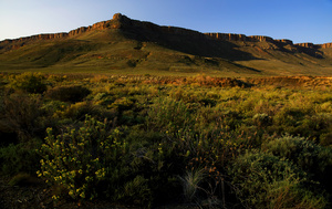
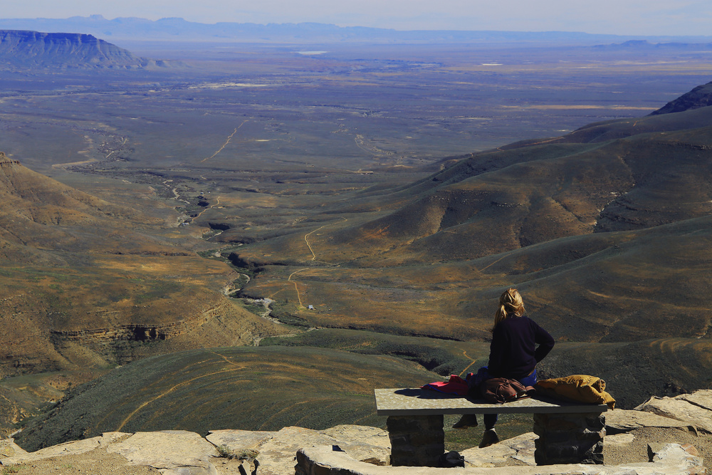
Great Karoo

Photos (18)

Cover
The escarpment / The central area of South Africa is a huge plateau called Karoo, a dry region with wide landscapes and blue skies.In some places the land rises abruptly from the lowlands of the coast like in the Tankwa River valley, where this escarpment is clearly visible.
File: IMG_3438-FB.jpg
Horizons / A viewpoint at Bloukranspas, overlooking the Tankwa Karoo. The Cederberg mountains are visible on the horizon, about 15 Km far away from the pass.
File: IMG_5598-FB.jpg
Bloukranspas / Bloukrans Pass, on the untarred road from Calvinia to Ceres, offers breathtaking views on the Tankwa Karoo, the region between the Cederberg and the Great Karoo.
File: IMG_5603-FB.jpg
On the edge / A Red Hartebeest (Alcelaphus buselaphus), one of the most common antelope in South Africa, on the edge of a canyon in the Karoo National Park.
File: IMG_3236-FB.jpg
Coming storm / Anywhere in the Karoo you can see windmills, used to pump water in this arid and windy region.They seldom stand still like here, as they watch a storm coming over the plateau.
File: IMG_3353-FB.jpg
Wind and bush / At a height of 1,500 m  on the Great Karoo central plateau, the wind bloes all the time over the bush.
File: IMG_3547-FB.jpg
Open land / Wide spaces of the Great Karoo, Winter 2015
File: IMG_3623-FB.jpg
Straight ahead / Excuse me, which way is Ceres? Always straight ahead! Make sure you have a reliable vehicle and full tank ...
File: IMG_5656-FB.jpg
Big sky / Wide space and big sky in the Great Karoo.
File: IMG_5666-FB.jpg
Karoo architecture / A small building in the Tankwa Karoo, maybe used in the past as a dwelling by shepherds
File: IMG_1907-correct-FB.jpg
Langkloof Canyon / Langkloof Canyon, Tankwa Karoo National Park
File: IMG_2069-FB.jpg
Tankwa Karoo landscape / From a vantage viewpoint the eye wanders on the plains and hills of the Tankwa Karoo up to the horizon and the far away Cederberg Mountains.
File: IMG_2236---FB.jpg
High altitude marshes / A marsh at 1,500 m on the Great Karoo plateau, Winter 2015
File: IMG_3363-FB.jpg
This was / This was a windmill used to pump water in the dry bush of the Great Karoo ...
File: IMG_3642-FB.jpg
Groot Karoo / A typical landscape of the Great Karoo (Groot Karoo in Afrikaans): dry, semi-desert vegetation, no trees, wide spaces and blue skies.
File: IMG_5630-FB.jpg
MIddelpos Post Office / The post office of Middelpos, a tiny village in western Karoo. Besides the post office or poskantoor, there is a hotel and a memorial to the soldiers fallen in a skirmish during the second anglo-boer war.
File: IMG_2279-cropped---FB.jpg
Karoo highlands / The Karoo highlands are frequently crossed by large outcrops with a flat top, like this one in a private reserve near Calvinia, Northern Cape.
File: IMG_3647-correct-FB.jpg
Tankwa Karoo highlands / This is a pano of the Tankwa Karoo highlands, located between the Great Karoo and the Cederberg Mountain Range. A land of wide spaces, untarred roads and very few people.The Tankwa Karoo is a plateau at an altitude from about 900 m above sea level to over 1,200 m above sea level. Until the end of the XIX century, huge herds of Springbok roamed on these plains.
File: Pano-IMG_2255-+-IMG_2257-FB.jpg