
Lost in Sight: In Search of the Flint's Headwaters
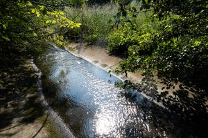
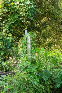
On any given day, some 260,000 passengers fly in and out of Hartsfield Jackson International Airport in Atlanta, one of the busiest airport in the world. Beneath the tarmac, unknown to most people, flows the headwaters of one of the most scenic rivers in the southeast of the United States, the Flint. Georgia’s second largest river, the Flint flows through the hills of the southern piedmonts all the way to the Florida panhandle, 344 miles below. Its headwaters start with a few urban streams in three communities just north of the airport, emerging from storm sewers and culverts - the legacy of railroad towns that have become a part of the sprawl of a metropolitan city. They join together to flow under the airport through pipes for about a mile and a half, below the five runways and countless parking lots. From there, it meanders through more industrials zones, stone-extraction facilities, and along two major highways, to finally reach a swampy riparian area and its first public access 15 miles south of its groundwater seepages. This project attempts to restore a visual identity to a river whose origin has been lost in sight, and asks the viewer to acknowledge the dangerous human infatuation with controlling and managing nature to its needs. It would have been tempting to follow the Flint river down its estuary and offer a vision of this troubled river in its entirety. I decided to stay within the limited geographical space of the headwaters because of its symbolism - this is the place where the river starts - and to end my exploration where the river gets its major public access.
No categories selected
Photos (7)