Safeguarding the Venetian Lagoon
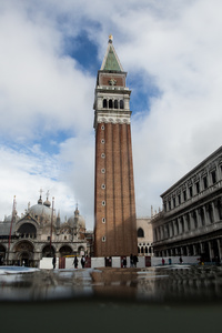
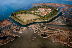
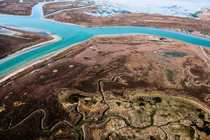
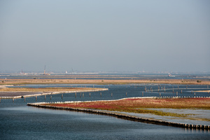
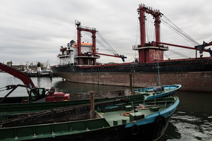
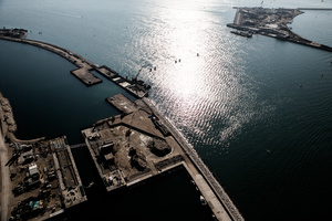
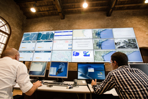
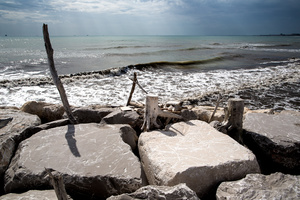
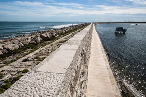
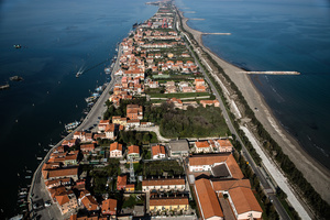
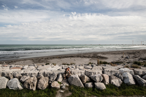
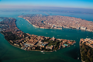
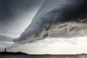
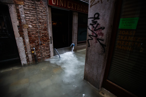
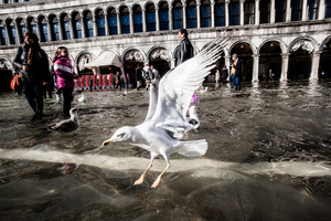
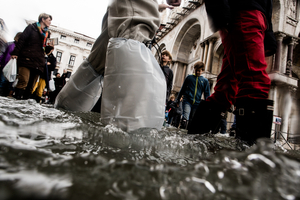
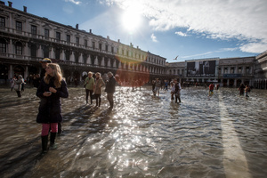
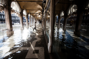
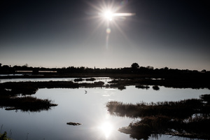
Photos (29)

High tides flood Venice regularily, especially the San Marco Square. One of the highest tides in recent years struck Venice on November 1, 2012. It reached around 140 cm above the regular tide and flooded more than half of Venice.
File: VeniceLagoon-PhotoLukaDakskobler-001.jpg
The salt marshes around San Francesco del Deserto island in the north lagoon have all been reconstructed by the Consorzio Venezia Nuova after they have completely disappeared mostly due to high tides. So far over 1,430 hectares of salt marshes have been recreated. Presently, most extensive reconstruction work is underway in the south Venetian lagoon to rebuild salt marshes.
File: VeniceLagoon-PhotoLukaDakskobler-002.jpg
Charles Ray\'s sculpture The Boy with a Frog stands on the very tip of the Punta della Dogana in Venice while a large cruise ship passes through the Grand Canal. Heavy traffic of these large ships is believed to cause deterioration of the biodiversity of the lagoon, because large ships displace a lot of water, cause waves that destroy the salt marshes and wash away the soil.
File: VeniceLagoon-PhotoLukaDakskobler-003.jpg
Heavy traffic in the narrow canals of the city of Venice displaces a lot of water and causes strong wave action. Continuous striking of waves against the facades causes damage to the buildings, destabilizes them and weakenes the foundations.
File: VeniceLagoon-PhotoLukaDakskobler-004.jpg
Typical lagoon structures consist of mudlats, salt marshes and meandering canals used to navigate through to the islands in the lagoon.
File: VeniceLagoon-PhotoLukaDakskobler-005.jpg
People ride the water bus or vaporetto from the islands in the north lagoon back to the city of Venice on September 23, 2012. The wide lagoon is in fact only a meter deep. The boat routes are a clearly marked deepened canal system.
File: VeniceLagoon-PhotoLukaDakskobler-006.jpg
Traffic in Venice, September 26, 2012.
File: VeniceLagoon-PhotoLukaDakskobler-007.jpg
Damage to the facades of buildings in the city of Venice is caused by continuous wave action from boats and from natural causes, especially strong scirocco and bora winds, storms and of course frequent high tides.
File: VeniceLagoon-PhotoLukaDakskobler-008.jpg
An extensive reconstruction work is underway in the south Venetian lagoon to rebuild salt marshes and reinforce their shores to protect them from waves that erode them and eventually destroy them.
File: VeniceLagoon-PhotoLukaDakskobler-009.jpg
The south lagoon is a major construction site. The Consorzio Venezia Nuova is extensively reconstructing the salt marshes and reinforcing their shores, while also building wavebreaks.
File: VeniceLagoon-PhotoLukaDakskobler-010.jpg
The police monitors the implementation of enviromental laws in the lagoon. Besides poaching and other violations in the lagoon itself, Marghera (in the background), the main source of pollution of the lagoon, remains a major problem.
File: VeniceLagoon-PhotoLukaDakskobler-011.jpg
A strange circle of vegetation is seen on one of three islands created fifty years ago when the industrial district of Marghera dug a deep canal in the lagoon to allow the passage of large cargo ships and dumped the material here to create ground for a new housing project. The Venetians were against it and shut the project down. The islands are an important bird and plants habitat.
File: VeniceLagoon-PhotoLukaDakskobler-012.jpg
The Marghera port is a sight very far from the beauty of Venice. Rusting steel of large cargo ships and heavy machinery. It lies just a couple of kilometers from the city of Venice.
File: VeniceLagoon-PhotoLukaDakskobler-013.jpg
The MOSE project flood gates will soon be installed on all three lagoon inlets. Lido, Malamocco and Chioggia. The gates will rise to prevent high tides flooding the lagoon. In October 2012, the concrete caissons that will host the gates were already installed on the Lido inlet seabed. Work underwater was underway. Workers descended to the caissons through shafts seen here emerging out of the water
File: VeniceLagoon-PhotoLukaDakskobler-014.jpg
The MOSE project control room is where scientists will monitor weather, predict high tides well ahead, issue warnings and operate the gates. It is located in Venice Arsenal and allows scientists to monitor the entire lagoon from Jesolo to Chioggia.
File: VeniceLagoon-PhotoLukaDakskobler-015.jpg
All lagoon inlets were reinforced to hold back high waves, caused by strong winds and storms in the Adriatic Sea.
File: VeniceLagoon-PhotoLukaDakskobler-016.jpg
A strong high wall called the Murazzi stretches some 20 km along the barrier island of Pellestrina to protect the lagoon from open sea and the waves that come with storms. The wall was built over two hundred years ago and was restored in the 1970s.
File: VeniceLagoon-PhotoLukaDakskobler-017.jpg
The murazzi wall runs the entire length of the Pellestrina barrier island, and a part of Lido island further north. Furthermore, the entire sea coast has been reinforced.
File: VeniceLagoon-PhotoLukaDakskobler-018.jpg
Construction cranes of the MOSE project are seen behind a wavebreak at Chioggia inlet on September 28, 2012. All inlets have been reinforced years ago.
File: VeniceLagoon-PhotoLukaDakskobler-019.jpg
A man climbs over the final stretch of the murazzi wall on the Pellestrina island on September 27, 2012. The tip of the island breaking into the reinforced inlet has seen massive deposits since the inlets were reinforced. The sandy corner of the island became a safehaven for birds, and later officially named a bird sanctuary.
File: VeniceLagoon-PhotoLukaDakskobler-020.jpg
Venice, October 24, 2012
File: VeniceLagoon-PhotoLukaDakskobler-021.jpg
A storm cloud hangs above the San Servolo Island in central lagoon near the main island of Venice on September 26, 2012. Venice is subject to strong storms, Bora and scirocco winds that bring waves and high tides that eventually flood the city. Storms at sea and inland are especially dangerous. The open sea storms bring tides, while the inland storms bring flooding from rivers.
File: VeniceLagoon-PhotoLukaDakskobler-022.jpg
Cover
A storm looms over the city of Venice on September 26, 2012. Venice is subject to strong storms, Bora and scirocco winds that bring waves and high tides that eventually flood the city. Storms at sea and inland are especially dangerous. The open sea storms bring tides, while the inland storms bring flooding from rivers that flow into the lagoon.
File: VeniceLagoon-PhotoLukaDakskobler-023.jpg
Floodwater is pumped out of a building in Venice during one of the highest floods in recent years on November 1, 2012. The city is sinking one to two milimeters a year, while the north lagoon is subsiding 2 to 3 mm a year and the islands in the south lagoon are sinking at a rate of 3 to 4 mm a year. This subsidence will have to be accounted for by the scientists trying to protect the lagoon.
File: VeniceLagoon-PhotoLukaDakskobler-024.jpg
Tourists stroll the city in boots or on boardwalks among seagulls swimming around them.Flooding causes major structural damage to the foundations and the buildings in Venice. Tides carry away soil from the bottom and cause Venice to sink even faster in some places. Buildings are therefore structurally instable and several reconstruction works are underway.
File: VeniceLagoon-PhotoLukaDakskobler-025.jpg
During high tides, a boardwalk is set up in the streets and squares of Venice and tourists can get boots to walk in the flooded streets.
File: VeniceLagoon-PhotoLukaDakskobler-026.jpg
Strolling the flooded streets of Venice has become a new Venetian attraction. Everybody now knows Venice is sinking, but few actually realise that Venice could actually go under if no measures to save it were underway.
File: VeniceLagoon-PhotoLukaDakskobler-027.jpg
Venice, San Marco Square, November 1, 2012.
File: VeniceLagoon-PhotoLukaDakskobler-028.jpg
An egret is strolling the lagoon near Lio Picolo in the north lagoon on October 23, 2012. The lagoon is sinking along with the city of Venice. The city is sinking one to two milimeters a year, while the north lagoon seen here is subsiding 2 to 3 mm a year and the islands in the south lagoon are sinking at a rate of 3 to 4 mm a year.
File: VeniceLagoon-PhotoLukaDakskobler-029.jpg