
The Low Land
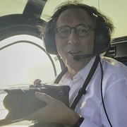
The Low Land is a project about the present, past and future of the Netherlands as lowland neighbouring the sea, delta of the rivers. In a period of four years, photographer Siebe Swart used a helicopter not only to photograph the entire coastline from south to the north, he also made an inventory of the great rivers Meuse, Scheldt, Rhine and IJssel. The unique aerial photos show how floods have scared the landscape, what danger the water entails and how dikes, barriers, overflow channels and weirs protect the fragile country. The struggele against the water continues in this time of climate change.
Photos
22
Status
Public
Created
Nov 29, 2013
Updated
Jan 08, 2025
Categories
Landscape
Documentary
Tags
#Aerials
#Climate Change
#Documentary
#Flooding
#Landscape
#Protection
#Water. Holland
#Netherlands
Photos (22)
Cover

File:
01_Cover_TheLowLand.jpg

File:
02_SMS_20090612_0140.jpg

File:
03_SMS_20101003_495.jpg

File:
04_SMS_140708_0635.jpg

File:
05_SMS_20090612_0190.jpg

File:
06_SMS_20060704_1456.jpg

File:
07_SMS_20090919_0084.jpg

File:
08_SMS_20100130_0341.jpg

File:
08_SMS_20110120_0082.jpg

File:
09_SMS_140708_0034.jpg

File:
10_SMS_20080211_0461.jpg

File:
11_SMS_20110110_093.jpg

File:
12_SMS_20090612_0664.jpg

File:
13_SMS_20090612_0668.jpg

File:
14_SMS_20100428_0359.jpg

File:
15_SMS_20110110_343.jpg

File:
16_SMS_20100428_0127.jpg

File:
17_SMS_20080211_0402.A4.crop.jpg

File:
18_SMS_20090908_0548.jpg

File:
19_SMS_20090612_0716.jpg

File:
20_SMS_20090612_050bis.jpg

File:
11_SMS_20110522_012.jpg
Add To Collection
No photos
Collaborated